
Highly accurate terrestrial laser scanning for architectural, topographical, and construction projects.
Until recently, achieving detailed and accurate As-Built land and building measured surveys required numerous staff members and a significant amount of time. Today, a professional 3d laser scanning survey solves this problem. With the help of class 1 laser scanners, what previously took days to survey can now be achieved in a matter of hours.
What is 3D Laser Scanning?
If you are asking what is 3d laser scanning, it is the process of contactless digital data collection of appearance, shape, and measurements from real-world objects. After the first invention of a laser in the 1960s, LiDAR (Light Detection and Ranging) was initially tested on airplanes. However, fully functional LiDAR laser scanners were only available in the late 1980s.
Today, using a laser scanner in surveying is the industry standard. In the construction, design, and architectural fields, the 3D captured data is used for:
- Constructing accurate and scaled 3D models.
- Virtual tours around the scanned site.
- Production of accurate As-Built architectural CAD drawings (floor plans, section drawings, elevation drawings).
- Extraction of areas, volumes, and exact spatial measurements.
What is Terrestrial Laser Scanning?
Another common question is: what is terrestrial laser scanning? Terrestrial laser scanning (TLS), also known as terrestrial LiDAR, refers to static, tripod-mounted laser scanners used for highly precise ground-level surveys. Professional terrestrial laser scanners typically have a range of 70 to 350 metres with an accuracy of +- 2mm.
These devices are mostly used in the following fields:
- Surveying – Building measured surveys, topographical land surveys, and structure health monitoring.
- Construction field – Performing quality control during and after the construction project is completed.
- Forensic investigations – Scanning the scenes and capturing all data to the millimetre.
What is Laser Scanning Used for in Construction Projects?
In modern architecture and development, 3D laser scanning allows to solve many crucial tasks:
- Measured Building Surveys
Creating accurate As-Built drawings of any kind with as much or as little detail as required by the architect.
- Topographical & Property Surveys
Creating accurate and scaled 3D models of surveyed buildings, objects, and land terrain.
- Structure Health Monitoring
Analysing the degree of deformation of a structure by comparing data from different points in time.
- Construction Quality Control
Verifying proposed architectural designs against actual As-Built works on the construction site to prevent clashes and costly errors.
Main Benefits of 3D Laser Scanning Services
- Speed
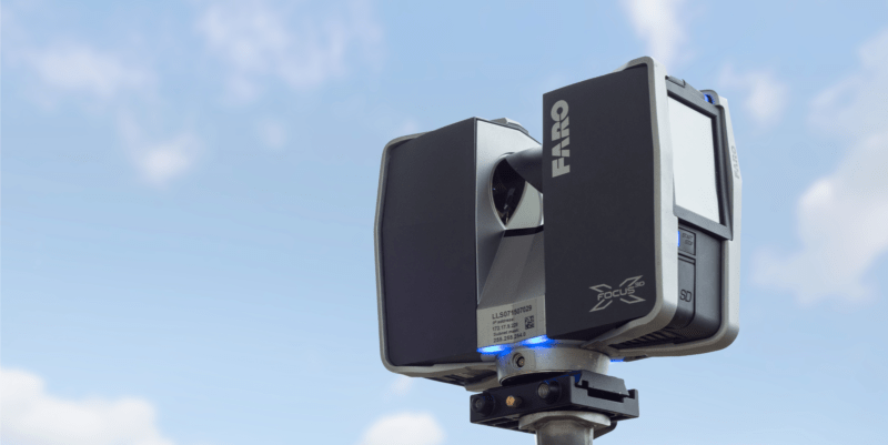
Our Faro 3D laser scanner captures up to 1 million points per second. In just minutes, it completes a 360° by 300° scan.
- Accuracy
The Faro X130 scanner has a range of 130 metres with an accuracy of just +-2mm, eliminating the human error factor.
- Surveying hard to access areas
With a long range, we can precisely capture measurements of high ceilings, complex roofs, and building elevations without scaffolding.
- Suitable for sensitive environments
As a contactless method of survey, laser scanning 3d is the perfect choice for surveying sensitive properties such as churches and listed heritage buildings.
How Does a Laser Scanner Work?
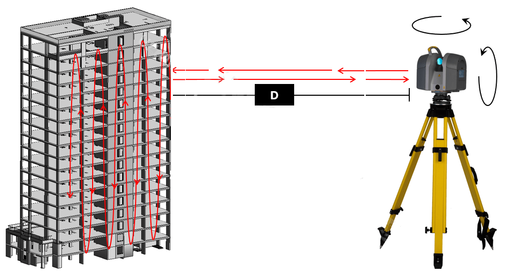
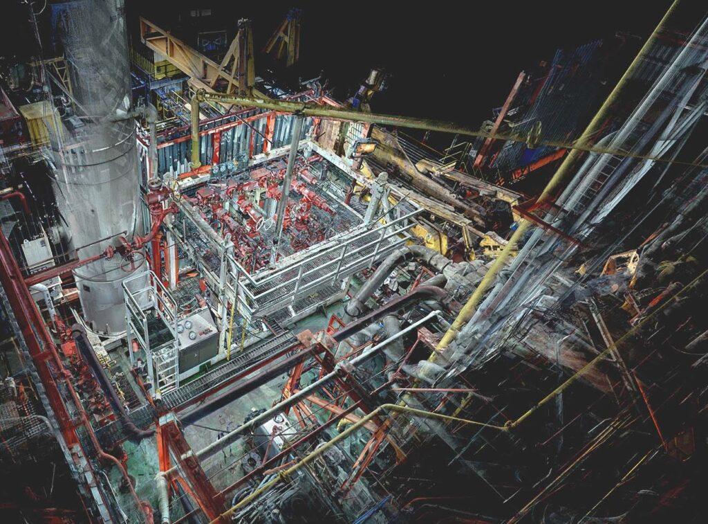
A 3D laser scanner works by sweeping a laser beam in all directions (usually 360° by 300°). The scanner calculates the distance to an object by measuring the time it takes for the laser beam to hit a surface and bounce back. Unlike normal rangefinders, terrestrial scanners record data in x, y, and z coordinates, converting the surveyed data into a highly detailed 3D representation known as a Point Cloud.
Frequently Asked Questions
What software works best with 3D laser scan data?
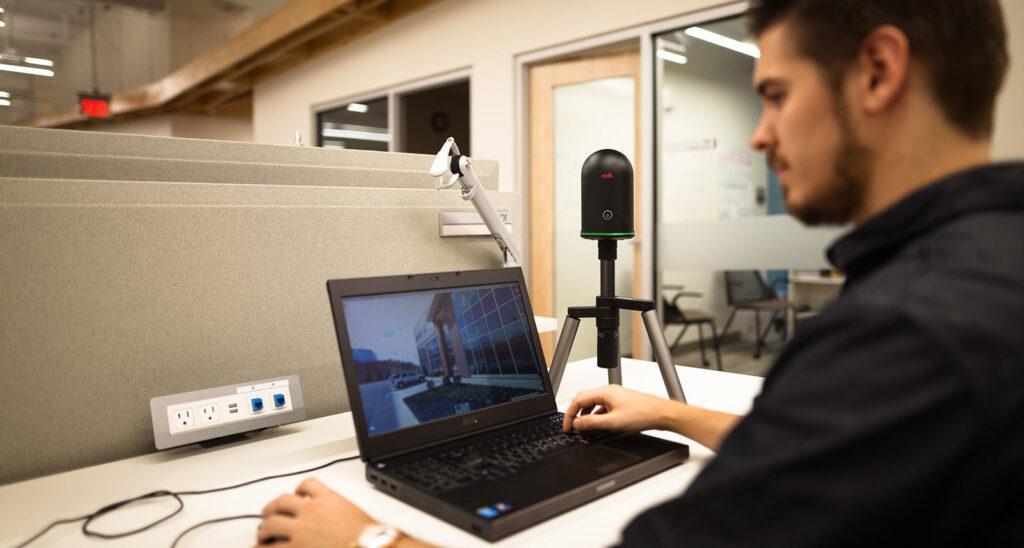
Once the raw data is captured, it needs to be processed. The industry standard software for registering scans into a Point Cloud includes Faro Scene and Leica Cyclone. For creating final 2D drawings and 3D models from that data, Autodesk Revit and AutoCAD are considered the best software solutions in the architectural field.
How much does a terrestrial laser scanner cost to purchase?
If you plan to buy the equipment, entry-level terrestrial 3D laser scanners from industry-leading manufacturers cost from around £30,000. Advanced models can cost up to £100,000. Additionally, software for processing Point Clouds costs between £7,000 and £10,000, plus the requirement for a high-end processing PC.
Where to find providers of 3D laser scanning services in London?
Purchasing the equipment is often not viable for a single project. If you need reliable providers of 3D laser scanning services in London, our team at Measured Survey PRO offers fully equipped surveyors ready to deploy to your site. We handle the scanning, processing, and delivery of final CAD/BIM outputs.
