

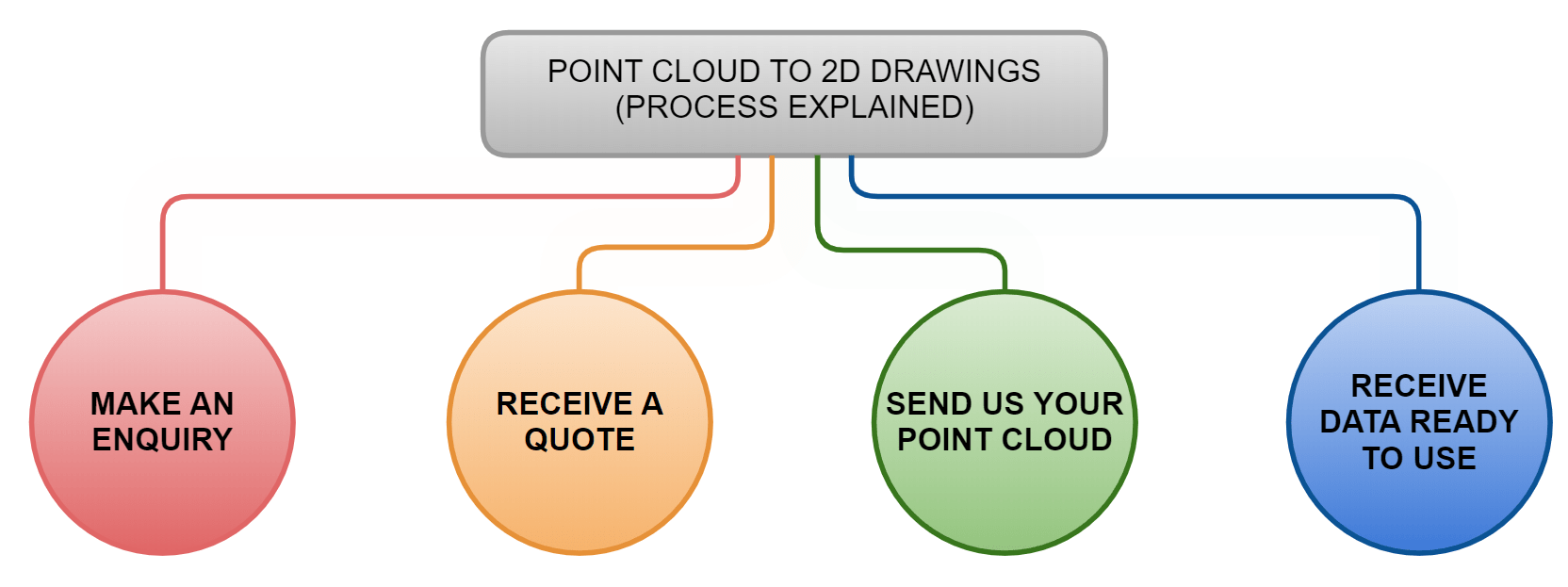
Turn Your Point Cloud into Accurate, Ready-to-Use CAD Drawings
Professional Scan to CAD services for surveying companies, architects, engineers and construction teams. Send us your registered Point Cloud and we will convert it into clear 2D CAD floor plans, elevations, sections and other agreed drawings in DWG and PDF formats.
Point Cloud → DWG / PDF • Plans • Elevations • Sections • Remote UK Drafting
Already have the scan? Send the Point Cloud, required drawings and CAD standard for a project-specific quotation.
Input
Registered Point Cloud
Primary Output
Layered DWG / PDF
Service Type
Remote CAD Production
Scan to CAD Deliverables
- Point Cloud to DWG
- 2D floor plans
- External elevations
- Building sections
- Internal elevations where required
- Roof plans
- Reflected ceiling plans where required
- Layered CAD drawings to agreed standards
- PDF review and issue drawings
Professional Scan to CAD Services from Point Cloud Data
Scan to CAD converts registered laser-scan Point Cloud data into clear, scaled and usable 2D architectural drawings.
If your site has already been scanned, there is usually no reason to commission another measured survey simply because you need DWG drawings. Our CAD team can work directly from the existing measured dataset and produce the plans, elevations and sections required by your project.
This service is particularly useful for surveying companies that want to outsource drawing production, architectural practices that have received Point Cloud data from another consultant and contractors who require accurate as-built CAD information from an existing scan.
Already have a Point Cloud? Send us the dataset or a representative sample. We can check the data before quotation and confirm whether it contains the coverage required for your drawings.
What CAD Drawings Can We Produce from a Point Cloud?
Floor Plans
Existing layouts showing walls, openings, doors, windows, stairs, columns and other agreed visible architectural features.
External Elevations
Measured façade drawings showing visible openings, rooflines and agreed external architectural detail.
Building Sections
Vertical cuts through the Point Cloud showing floor relationships, ceilings, stairs, roof geometry and other required information.
Internal Elevations
Detailed room or wall elevations for fit-out, interiors, heritage and other projects requiring vertical internal information.
Roof Plans
Measured roof geometry based on visible scanned surfaces, including ridges, valleys, parapets and agreed features.
Reflected Ceiling Plans
Ceiling geometry and agreed visible features for commercial fit-out and architectural projects where the Point Cloud provides suitable coverage.
Point Cloud to DWG: More Than Simply Tracing Points
Producing a professional drawing from a Point Cloud involves interpretation as well as measurement.
Existing buildings rarely contain perfectly straight walls, square rooms or idealised construction geometry. Furniture may obscure surfaces, some features may have limited scan coverage and the required drawing representation depends on the intended use of the output.
Our drafting workflow therefore uses the Point Cloud as the measured reference while applying the agreed drawing conventions, scope and level of detail.
CAD Layers, Templates & Client Standards
A CAD drawing is most valuable when it can be inserted directly into the client’s existing design workflow.
Where supplied, we can work to agreed:
- CAD layer structures;
- drawing templates;
- title blocks;
- line weights;
- linetypes;
- annotation conventions;
- drawing scales;
- units;
- coordinate systems;
- client-specific CAD standards.
No CAD standard? We can use our normal architectural drawing conventions and agree the expected presentation before production begins.
Which Point Cloud Formats Can We Work With?
Point Cloud workflows vary between surveying platforms and design software. Common datasets include Autodesk RCP/RCS and exchange formats such as E57.
If your Point Cloud is supplied in another format, send us the file details or a representative sample before quotation. We can confirm whether the dataset can be incorporated into the drafting workflow.
For efficient production, the Point Cloud should ideally be:
- correctly registered;
- complete enough for the required drawings;
- supplied in known units;
- provided with coordinate information where required;
- accompanied by any drawing brief or project standard;
- supported by photographs or scan imagery where interpretation may otherwise be unclear.
Our Scan to CAD Workflow
01
Send the Point Cloud
Upload the dataset or representative sample together with the drawings you require.
02
Data Review
We check the Point Cloud coverage, registration, format and suitability for the required drawing package.
03
Agree the Scope
Drawing types, scale, layers, templates, detail, coordinates, programme and quotation are confirmed.
04
CAD Production
Our drafting team creates the required plans, elevations and sections directly from the measured dataset.
05
Quality Review
The produced drawings are checked against the Point Cloud and agreed project requirements.
06
DWG / PDF Delivery
Final drawings are issued digitally in the agreed file formats for your design or construction team.
Why Outsource Point Cloud to CAD Drafting?
Increase drafting capacity during busy periods without maintaining unnecessary permanent overhead.
Our workflow is focused on extracting architectural drawings from measured scan data.
A suitable existing Point Cloud allows drafting to begin without another site visit.
Layer structures, templates and presentation can be tailored to an agreed office or project standard.
Order one floor plan, a complete building package or recurring production capacity depending on workload.
If the project later requires a Revit model, see our dedicated Scan to BIM service.
Who Uses Our Scan to CAD Service?
Keep field teams focused on scanning while outsourcing CAD production during high workloads.
Convert third-party survey data into clear existing-condition drawings ready for design.
Produce as-built plans and measured drawings from existing scan data.
Create reliable existing-property CAD records for refurbishment and redevelopment projects.
Generate base plans, elevations and sections for commercial and interior design work.
Send registered Point Cloud data remotely and use our CAD production team without another UK site visit.
Need a Revit Model Instead of CAD Drawings?
Scan to CAD and Scan to BIM use similar measured source data, but the final products are different.
If you need an editable 3D existing-condition model rather than conventional 2D plans, elevations and sections, use our Scan to BIM service.
Don’t Have a Point Cloud Yet?
If the property has not yet been scanned, our surveyors can provide the 3D Laser Scanning and registration before the CAD production begins.
Where you need both the site survey and a complete conventional architectural drawing package, our Measured Building Survey service may be the simpler starting point.
What Scan to CAD Cannot Recover from Missing Survey Data
CAD drafting can only represent information that is visible or otherwise supported by the supplied survey data.
If a part of the building was not scanned, is heavily obscured or is completely outside the Point Cloud, it cannot be recreated accurately simply through drafting.
Where critical areas are missing, we will identify the limitation and discuss whether additional source information or another site capture is required.
How Much Does Scan to CAD Cost?
The cost of converting a Point Cloud to CAD depends on the actual drafting workload rather than a universal price per square metre.
Important pricing factors include:
- building size;
- building and façade complexity;
- quality and completeness of the Point Cloud;
- number of drawings required;
- floor plans only versus elevations and sections;
- required drawing detail;
- client CAD standards and templates;
- coordinate requirements;
- required turnaround.
Send the Point Cloud or a sample together with the required drawings for the most accurate quotation.
Already Have the Scan?
Send us your Point Cloud and drawing brief. We will review the data and quote for the exact CAD production scope.
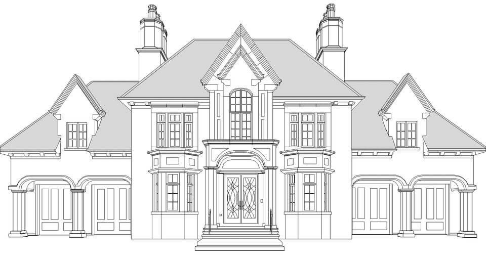
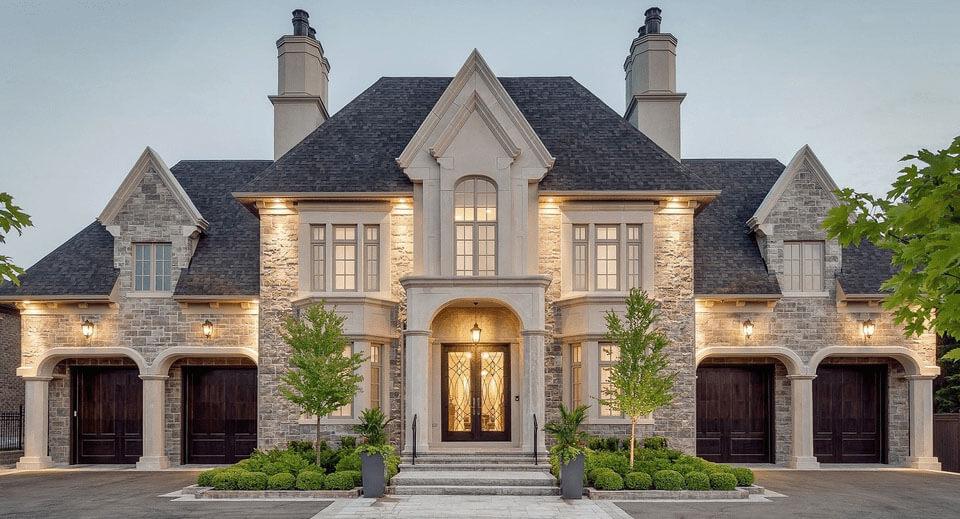
Sample CAD Drawings from Point Cloud Files
The examples below show the type of architectural drawings that can be produced from registered Point Cloud data.
Recent Point Cloud to DWG Projects
no images were found
Scan to CAD FAQ
What is Scan to CAD?
Scan to CAD is the process of using registered Point Cloud data as the measured reference for producing accurate 2D CAD drawings such as floor plans, elevations and sections.
Can you convert a Point Cloud to DWG?
Yes. Suitable registered Point Cloud data can be used to produce layered DWG floor plans, elevations, sections and other agreed architectural drawings.
Can you work from scans produced by another surveying company?
Yes. We can work from suitable registered Point Clouds captured by your company or another survey provider. Send a representative sample so we can check the data before quotation.
What drawings can you create from a Point Cloud?
Typical outputs include floor plans, external elevations, internal elevations, sections, roof plans and reflected ceiling plans where suitable survey data exists.
Can you follow our CAD layer standards?
Yes. Where CAD standards, templates, layer structures or title blocks are supplied, we can review them and incorporate the agreed requirements into the drafting scope.
What Point Cloud formats do you accept?
Common workflows include Autodesk RCP/RCS and E57. Other formats can be reviewed before quotation.
Do you also provide the laser scanning?
Yes. If you do not already have scan data, our survey team can provide the laser scanning and Point Cloud registration before CAD drafting begins.
What is the difference between Scan to CAD and Scan to BIM?
Scan to CAD creates conventional 2D drawings, normally DWG and PDF. Scan to BIM creates a structured 3D model, typically in Revit.
How do I send a large Point Cloud?
Point Clouds can normally be transferred using services such as WeTransfer, Dropbox or Google Drive. For very large datasets, contact us first so the most practical transfer method can be agreed.
Point Cloud Ready? Send It to Our CAD Team.
Send us the Point Cloud, required drawing types and CAD standard. We will review the data and provide a fixed quotation for the drafting scope.
