

Planning a house extension, loft conversion, refurbishment or other property change in London? This guide explains the planning route, the drawings that may be required, the role of local validation rules, and where an accurate measured survey fits into the process.
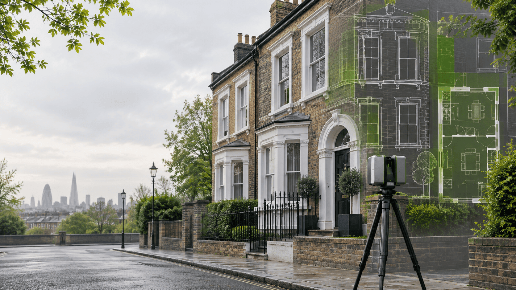
Check the planning route
Start by establishing whether the project needs planning permission, may be permitted development, or requires another planning route.
Check local requirements
London boroughs can require supporting information through an adopted local validation list.
Prepare accurate drawings
Existing and proposed drawings allow the authority to understand what is there now and what will change.
Need accurate existing drawings before design work starts?
If your architect or designer needs an up-to-date base, a measured survey can provide accurate existing plans, elevations and sections before proposed drawings are prepared.
Do I need planning permission in London?
Planning permission is the Local Planning Authority’s decision on whether a proposed development should be allowed to go ahead. For most London properties, the relevant Local Planning Authority is the borough council.
Not every project requires a full planning application. National permitted development rights allow certain works and changes of use to proceed without a normal planning application when all applicable limits and conditions are satisfied. The answer depends on the property, the proposed work and any restrictions affecting the site, so the planning route should be checked before drawings are finalised.
You may need a planning application when
- The work falls outside the relevant permitted development limits or conditions.
- The property type is not covered by the householder permitted development right being considered.
- Permitted development rights have been restricted or removed.
- The proposal involves development or a change of use that requires express permission.
You may have another route when
- The work complies with a relevant permitted development right.
- Prior approval is required under a specific permitted development class.
- You want formal confirmation through a Lawful Development Certificate.
- A specialist consent is needed in addition to, or instead of, a normal planning application.
Planning permission, permitted development and Lawful Development Certificates
| Route | What it means | Typical use |
|---|---|---|
| Planning permission | You ask the Local Planning Authority to decide whether the proposed development is acceptable. | Projects outside permitted development, many works to flats, larger or more complex changes, and other development requiring express permission. |
| Permitted development | A national grant of planning permission for specified development, subject to detailed limits and conditions. | Some house extensions, roof works and other defined classes of development. |
| Prior approval | Certain permitted development rights require the authority to approve specified matters before work proceeds. | Only where the relevant permitted development class specifically requires it. |
| Lawful Development Certificate | A legal certificate confirming that a proposed or existing use or operation is lawful for planning purposes. | Where you want formal evidence that planning permission is not required or that an existing situation is lawful. |
Permitted development is not simply a smaller version of a planning application. It is a separate route: the proposal must satisfy the relevant permitted development rules in full. Article 4 directions, planning conditions and other restrictions can remove or limit rights that would otherwise exist. Conservation areas and other protected locations can also affect which rights are available.
What makes a planning application valid?
Once the correct planning route is clear, the next question is whether the application contains enough information to be validated and assessed.
For applications for planning permission in England, national information requirements include plans and drawings, the relevant ownership certificate and agricultural land declaration, and in some cases a Design and Access Statement or Fire Statement. GOV.UK states that a location plan is the minimum drawing requirement, while additional plans and drawings will usually be needed to describe the proposal.
There is also a local layer. The Local Planning Authority may request supporting information through its published local list. This matters in London because borough requirements can differ by application type, scale and location, even when the same national rules apply.
What drawings may be required for a planning application?
The drawings are the visual evidence of the application: they identify the site, record the existing situation and show the proposed change clearly enough for the authority to assess it.
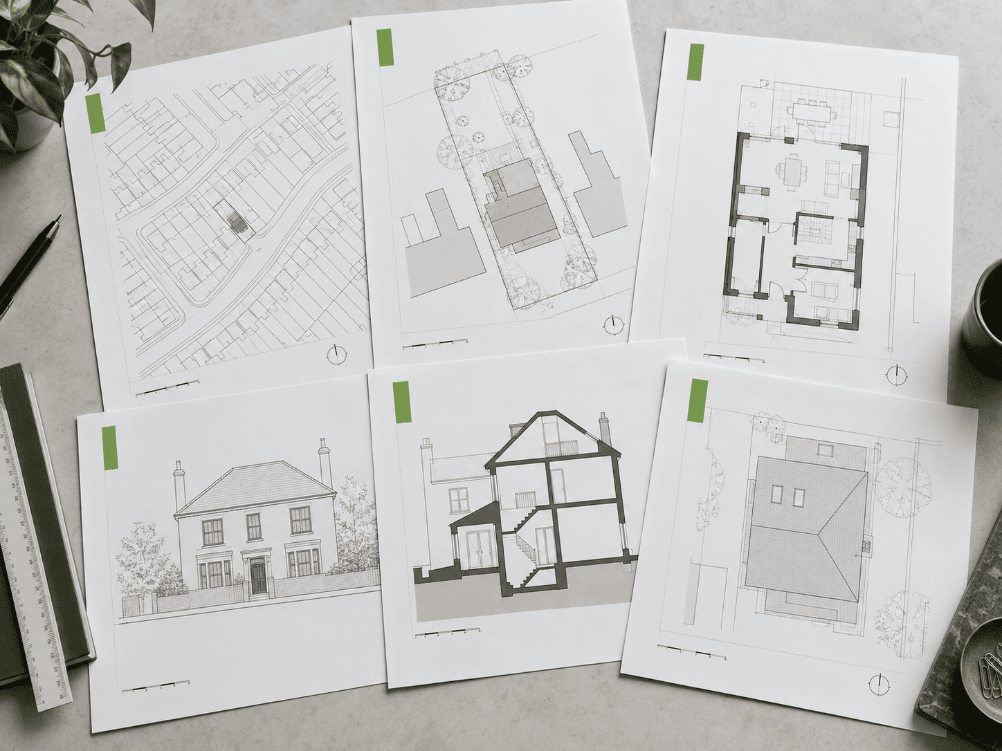
The exact drawing set depends on the works. Planning Portal guidance says plans and drawings are required with most application types, with the drawings varying according to the project. Typical drawing types include the following.
| Drawing | What it communicates | Typical scale / note |
|---|---|---|
| Location plan | Identifies the application site in its surrounding context. | Typically 1:1250 or 1:2500. GOV.UK describes this as the minimum planning drawing. |
| Site / block plan | Shows the site, boundaries, buildings, access and the proposed development in relation to the plot. | Planning Portal commonly refers to 1:200 or 1:500. |
| Existing floor plans | Shows the building layout before the proposed work. | Planning Portal commonly refers to 1:50 or 1:100. |
| Proposed floor plans | Shows how the layout will change as a result of the proposal. | Usually coordinated with the existing floor plan set. |
| Existing and proposed elevations | Shows affected external faces before and after the proposed work. | Planning Portal commonly refers to 1:50 or 1:100. |
| Roof plan | Shows roof form, features and changes where the roof is affected. | Planning Portal refers to 1:50 or 1:100 where roof changes are proposed. |
| Sections / details | Explains levels, height relationships or complex construction/design features. | Needed where necessary to explain the proposal or satisfy local validation requirements. |
This is not a universal checklist. A simple proposal may need fewer drawings, while a constrained or complex proposal can need additional plans, sections or supporting documents. Before submission, check both the current national requirements and the relevant borough’s local validation list.
Existing drawings vs proposed drawings
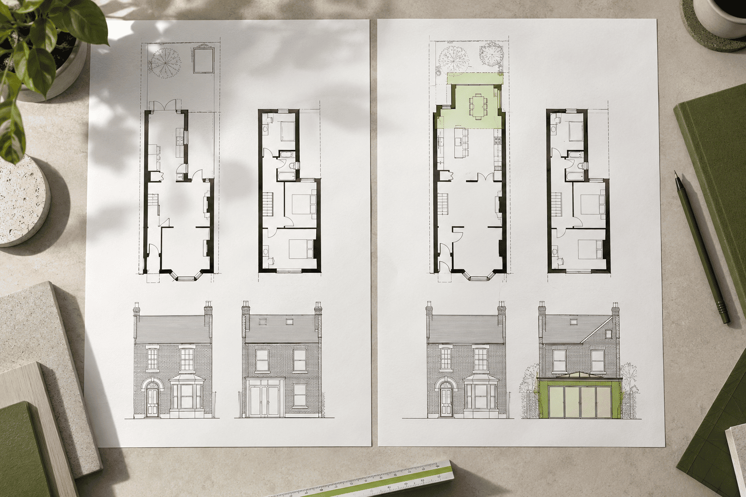
Planning drawings usually tell the story in two stages: what exists now and what is proposed to change. Keeping those two stages clear makes the application easier to understand and helps the design team coordinate the scheme.
Existing drawings
Record the property as it currently stands. Depending on the project, this can include floor plans, elevations, sections, roof information and site information.
These are the drawings a measured survey company such as MeasuredSurvey365 can produce from an on-site survey.
Proposed drawings
Show the design after the intended changes. They are usually developed by the architect, architectural designer or other project designer from the accurate existing information.
The authority compares the existing and proposed information to understand what is changing.
An estate-agent floor plan or an old drawing can be useful background information, but it should not automatically be treated as an accurate design base. If walls, levels, openings, roof geometry or extensions have changed—or if the drawing was never intended for design work—the property may need to be measured again.
When does a measured survey help with planning?
A measured survey is not a legal requirement for every planning application. Its role is practical: it sits near the start of the design process and gives the architect or designer reliable existing-condition information when accurate plans, elevations or sections are needed.
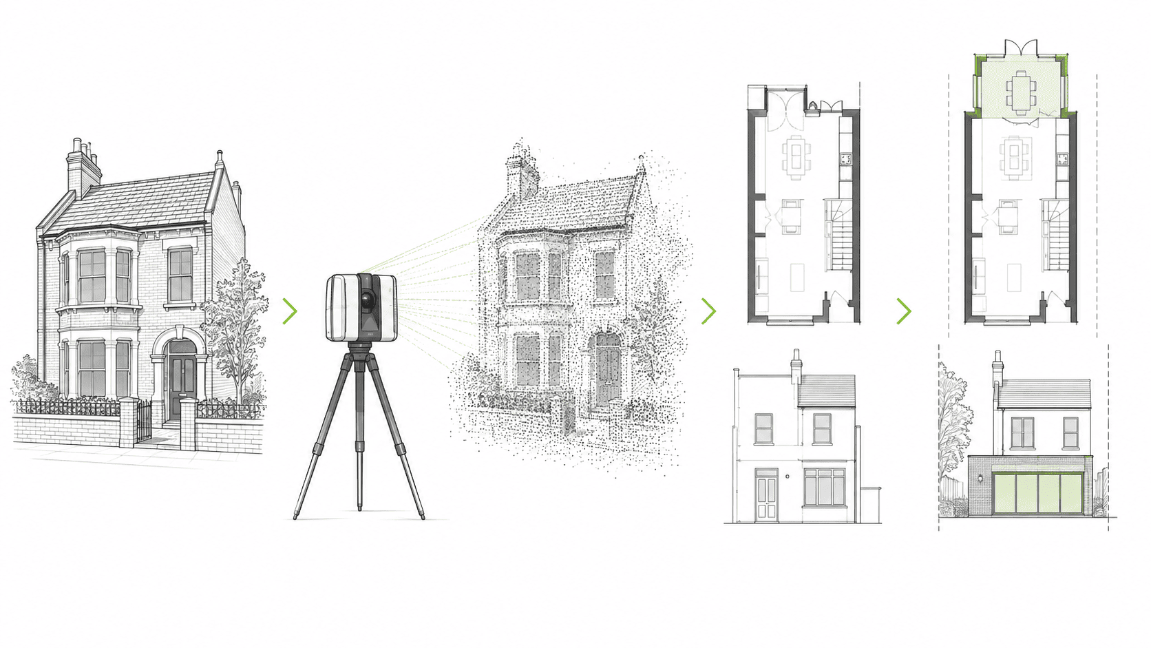
PropertyThe building as it exists today.
Site surveyDimensions and geometry are captured on site.
Existing drawingsPlans, elevations, sections or other agreed deliverables are prepared.
DesignThe architect or designer develops the proposed scheme from the existing base.
ApplicationThe required planning documents are assembled and submitted.
A measured survey is particularly useful when:
- No reliable existing drawings are available.
- The existing plans are old, incomplete or do not reflect later alterations.
- The proposal affects external appearance and accurate elevations are needed.
- Roof geometry, levels, extensions or complex wall positions matter to the design.
- The architect wants a dependable CAD base rather than redrawing from approximate information.
MeasuredSurvey365 provides measured building surveys in London, as-built drawings and related existing-condition deliverables. You can also review our measured survey drawing samples to see the type of existing information commonly produced.
Why London planning applications need borough-specific checks
The national rules are only part of the picture. GOV.UK guidance allows a Local Planning Authority to request supporting information through a formally adopted local list. That means the validation information requested in one borough may not be identical to the information requested in another.
Local validation list
Check the borough’s current published list for the relevant application type.
Article 4 directions
These can remove specific permitted development rights in defined areas or for defined forms of development.
Conservation / heritage constraints
Protected buildings and areas can affect the planning route and the level of information required.
For that reason, a London-wide checklist should be treated as a starting point rather than a final submission list. The current requirements of the borough handling the application should always be checked before submission.
Extensions, loft conversions, flats and other common London projects
House extensions
Some house extensions can be permitted development when all relevant conditions and limits are met. Projects outside those limits are likely to require a planning application. Certain larger rear extensions may use a permitted-development route that includes prior approval, subject to the relevant rules.
Loft conversions
Some loft conversions and roof alterations can fall within permitted development, but the rules depend on the property and the proposal. Roof plans, elevations and sections become particularly useful where the external roof form, height or appearance changes.
Flats and maisonettes
Do not assume the householder route for a single dwellinghouse applies to a flat or maisonette. Planning Portal states that the householder application process does not apply to flats, more than one house or changes of use.
A practical planning workflow
Putting the steps in the right order reduces rework: first establish the planning route, then gather reliable existing information, develop the proposal and finally assemble the application.
Check whether permission is required
Review permitted development, prior approval and other routes. If uncertain, obtain professional planning advice or speak to the Local Planning Authority.
Check constraints and local validation rules
Confirm the borough, application type, planning history and any relevant local or heritage constraints.
Prepare accurate existing information
Where reliable drawings are not available, commission a measured survey before design work progresses too far.
Develop the proposed design
Your architect or designer prepares proposed plans and other design information from the existing-condition base.
Assemble the application
Include the nationally required information and any relevant information on the Local Planning Authority’s current local list.
Validation and decision
Once the authority validates the application, the statutory determination period starts unless a longer period is agreed in writing.
How long does a planning application take?
GOV.UK states that, once a planning application has been validated, the statutory determination period is generally:
| Application category | Statutory period | Important note |
|---|---|---|
| Most non-major development | 8 weeks | Runs from validation, unless a longer period is agreed in writing. |
| Major development | 13 weeks | Major development has its own statutory definition. |
| Development subject to EIA | 16 weeks | Applies where an Environmental Impact Assessment is required. |
These are statutory determination periods after validation, not the total project programme. Time spent on surveys, design, pre-application work, document preparation or correcting an invalid submission comes before that clock, and the applicant and authority can also agree a longer determination period in writing.
Common mistakes before a planning application
- Assuming every home project needs planning permission. Some work may be permitted development, but the rules must be checked against the actual property and proposal.
- Assuming permitted development always applies. Article 4 directions, planning conditions, property type and other restrictions can change the answer.
- Using inaccurate old drawings as the design base. If the building no longer matches the drawings, errors can flow into the proposed scheme.
- Checking only national requirements. London boroughs can publish local validation requirements for particular application types and locations.
- Confusing planning permission with Building Regulations. They are separate approval systems.
- Submitting a generic drawing pack. The drawing set should explain the actual proposal and satisfy the relevant validation requirements.
Planning application FAQ
Do I always need a measured survey for a planning application?
No. A measured survey is not a universal legal requirement for every planning application. It is useful when the design team needs accurate existing plans, elevations, sections or other building information and reliable up-to-date drawings are not already available.
What is the minimum planning drawing requirement?
GOV.UK guidance states that a location plan showing the application site in relation to the surrounding area is the minimum. Additional plans and drawings will usually be needed to describe the proposed development.
Do I need existing and proposed floor plans?
Planning Portal guidance says floor plans are necessary for most application types and are likely to include both existing and proposed layouts. The exact requirements still depend on the application and Local Planning Authority.
Can I use an estate-agent floor plan for planning drawings?
It may be useful as background information, but an estate-agent plan is not automatically an accurate design or planning base. If dimensions, wall positions, openings, levels or later alterations matter to the proposal, your designer may require a current measured survey.
Does permitted development mean I can start work without checking anything else?
No. Permitted development rights have conditions and limitations, can be restricted by Article 4 directions or planning conditions, and do not replace other consent regimes such as Building Regulations where those apply.
How long does a normal planning application take?
For most non-major planning applications, the statutory determination period is eight weeks after validation unless a longer period is agreed in writing. Major applications are generally 13 weeks, while EIA development has a 16-week statutory period.
Are planning requirements the same across every London borough?
No. National requirements apply across England, but Local Planning Authorities can also maintain adopted local lists of supporting information requirements. Always check the current list for the borough handling the application.
Official planning sources used for this guide
Planning rules, permitted development rights and local validation requirements can change. Check the current official guidance and the relevant Local Planning Authority before relying on a requirement for a live project. This page provides general information for England and London and is not project-specific planning or legal advice.
- GOV.UK — Making an application
- GOV.UK — Determining a planning application
- GOV.UK — When is permission required?
- GOV.UK — Building regulations approval
- Planning Portal — Plans and drawings
- Planning Portal — Do you need planning permission?
- Planning Portal — Householder planning consent
Need a measured survey for your London project?
If your architect or designer needs accurate existing-condition drawings, we can survey the property and provide the agreed drawing package for the next stage of design.
